Yiftah to Ramot Naftali with Al-Hashvil, guided by Avi Farjioun
The first heavy rainfall of the season finally arrived the weekend before the hike. The rains were followed by a few days of sun and cooler temperatures. Put that together with the geological wonders of the Naftali mountain range and the scenic vistas of the Hula Valley. The result was a perfect autumn day for hiking on the Israel Trail.
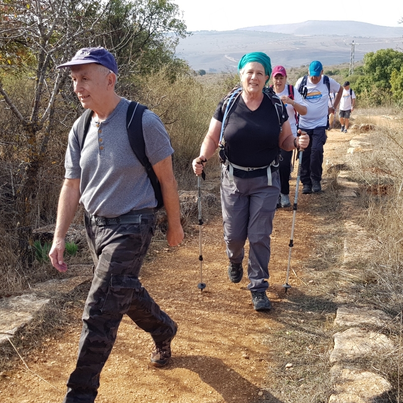
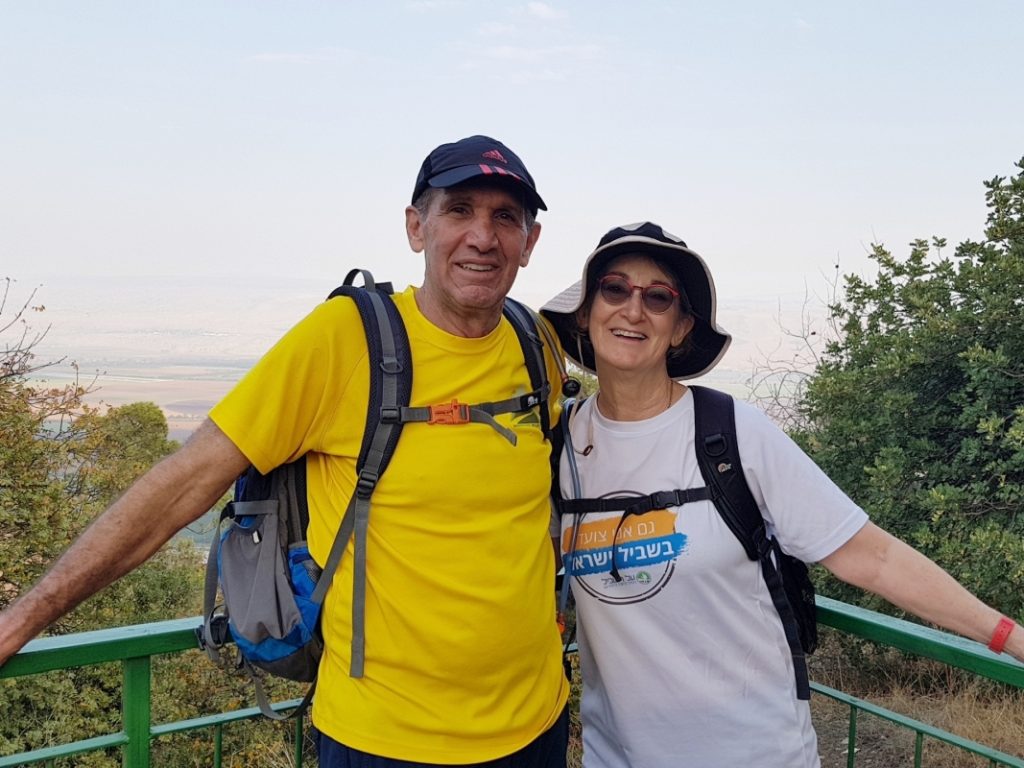
I had an extra hiking partner this time. Yuval registered for this hike since we had a family event the next day at Ayelet Hashachar. We booked a room in Rosh Pina for two nights, and treated ourselves to a mini-vacation. Tia drove up north on her own this time.
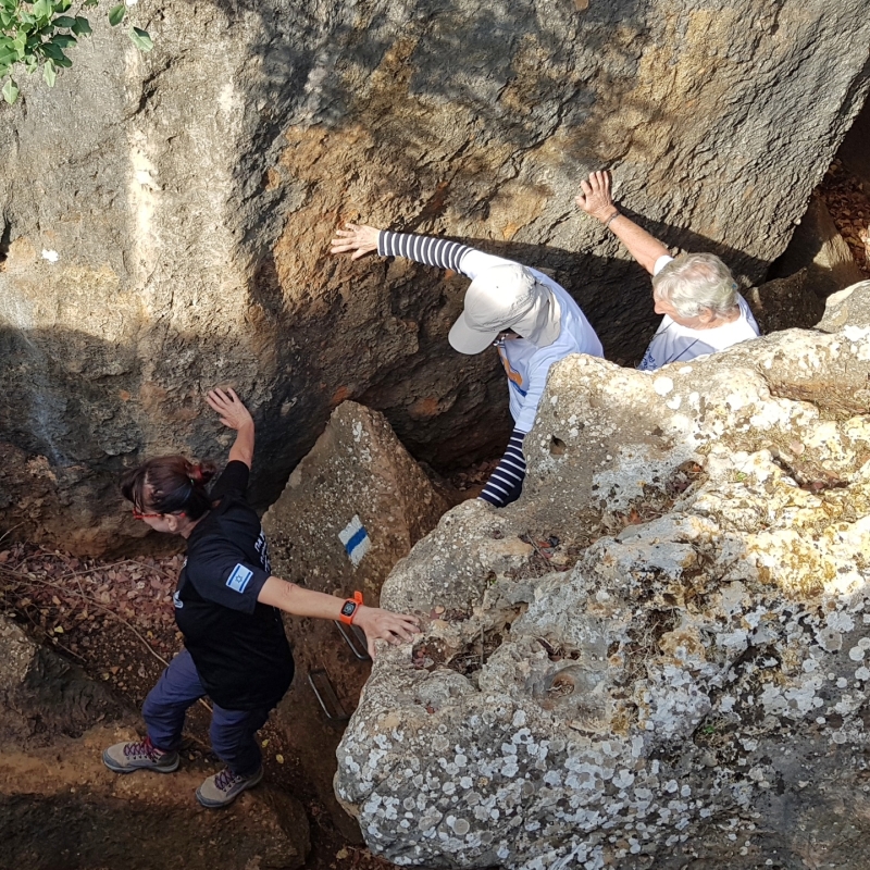
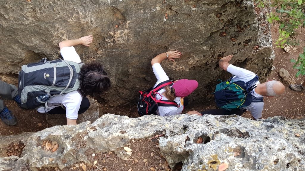
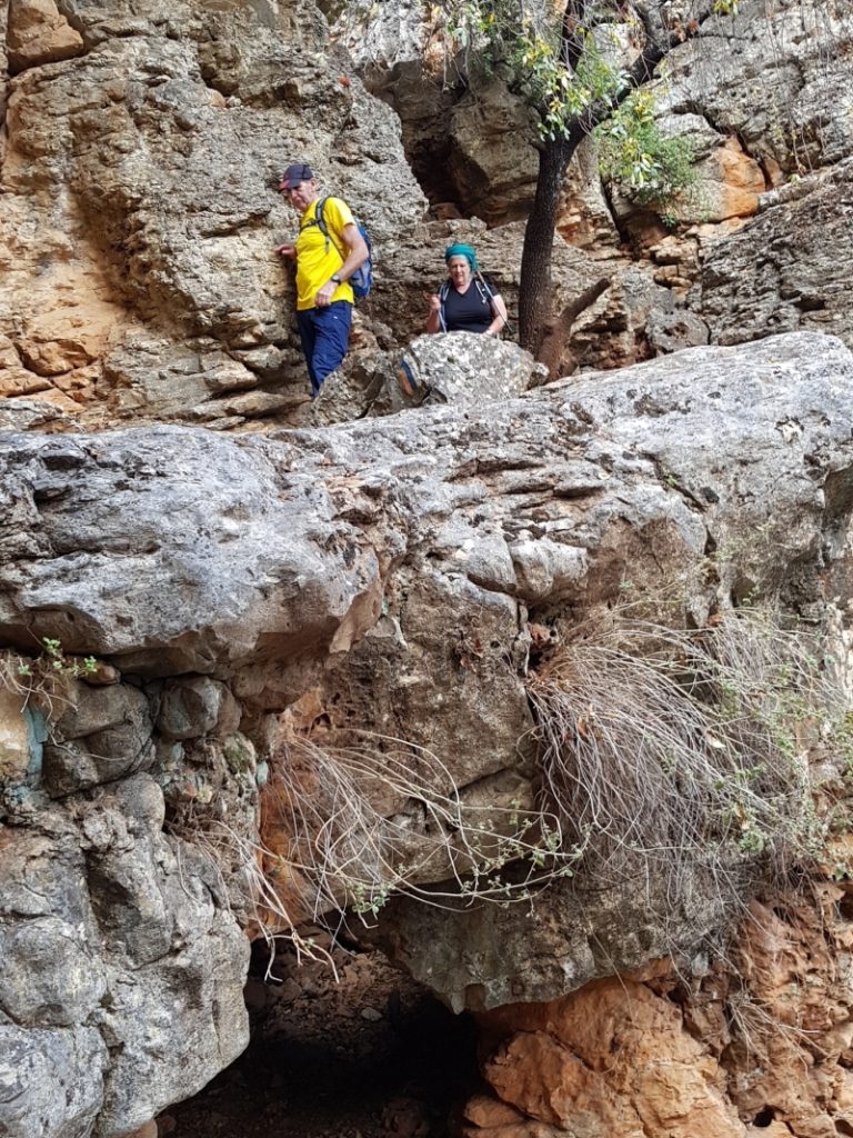
We started the hike slightly off-trail at Nikikei Yiftach, the Yiftah Fissures (or Crevices) Nature Reserve. The reserve has deep karstic fissures, created over eons in the dolomite and limestone. This geology gave us a mini-preview of the formations and climbing we would enconter later in the day in Wadi Kedesh.
After (almost) everyone did a short loop through the crevices, we headed east, and soon connected to the Israel Trail.
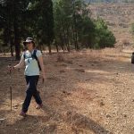
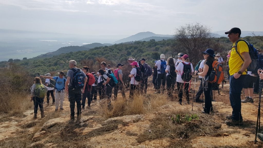
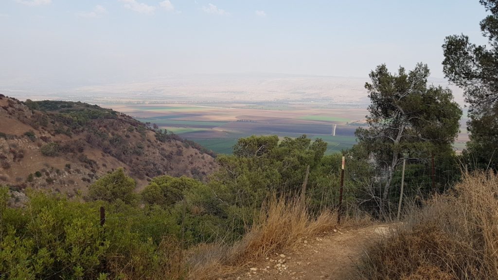
The autumn air felt fresh and clean from the rain. But the sky was overcast and cloudy thoughout the day, and the vistas remained hazy. So I am disappointed that my photos seem dull and flat.
Our first rest stop / morning snack break was in the shade alongside an open meadow, where learned about a squatter/shepherd who lives on the hill above.
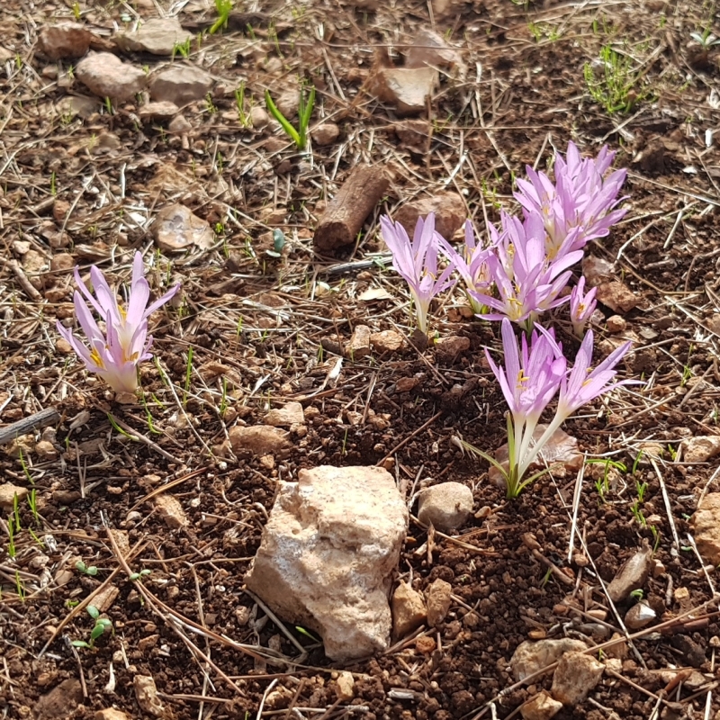
From there the trail descended, but hiking was easy. The ground was soft from the rain, but not muddy. The first of the Israeli wildflowers to sprout and bloom in the winter, sitvaniot, dotted the trail. While I was not the rearguard on this hike, I was mostly near the back. Consequently, my fellow hikers had trampled most of the blossoms before I reached them. Still, I found plenty of flowers to photograph.
The trail continued alongside and overlooking the Hula Valley. We saw signs of fire damage in the forested hills around us, but not as bad as on the last hike.
At one vista point, our guide Avi spoke about the draining of the Hula Valley swampland in the 1950s. Although considered a vital engineering and economic endeavor and achievement at the time, the adverse affects on the ecosystem and environment soon became apparent. Concern over the draining of the Hula led to the establishment of the Society for the Protection of Nature in Israel in the 1960s. Moreover, a small portion of the swampland was set aside to create the country’s first nature reserve.
Eventually the trail turned west and ascended through several switchbacks, until reaching the entrance gate to Wadi Kedesh Nature Reserve.
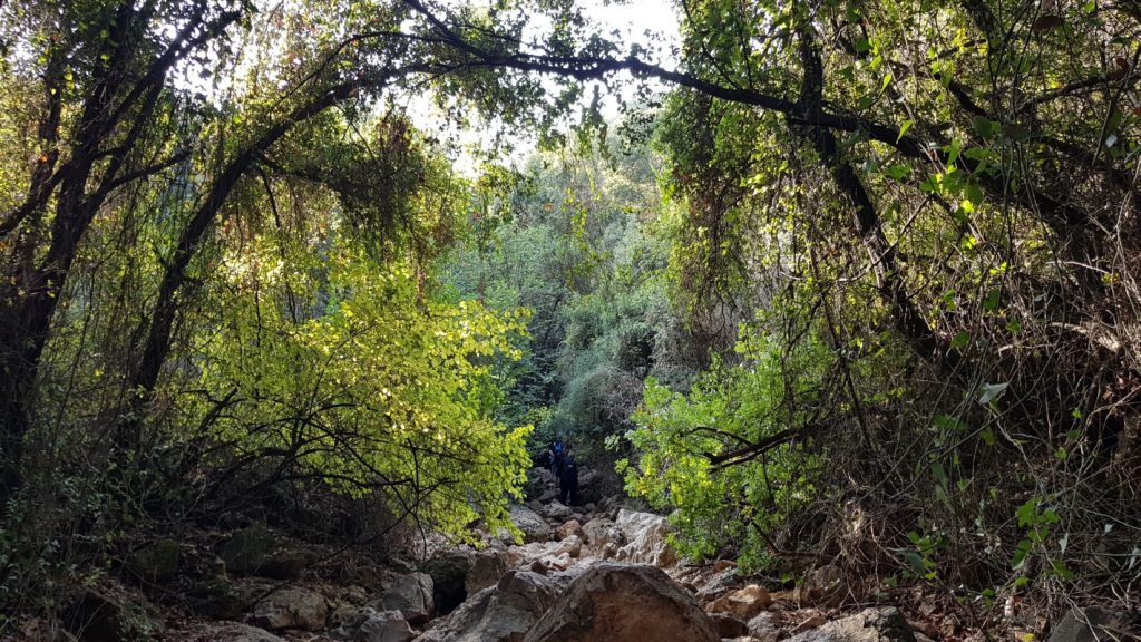
We stopped for our lunch break, and learned more about the geology of the unique canyon we were about to explore. Tia had some trepidation about this hike, especially because of Wadi Kedesh. I had assured her it was the most memorable and the most photogenic part of the hike, but it was just a short segment of it. And truly, that’s how it seemed. The imposing rocks and crevices, and the beauty of the leafy canopy seemed to end before I had fully absorbed the wonder of it all.
As we climbed out of the canyon, we once again overlooked the Hula Valley. We were now at Yesha fortress, also called Metzudat Koach (Fortress of Strength), a mandate-era British fortress, which had been built by Jewish workers in the Solel Boneh construction company.
In April 1948, after the British Army evacuated the Upper Galilee, Jewish forces attacked the strategically located fortress, which was held by armed Arab forces. Two failed attempts to gain control of the fortress ended in the death of 28 Jewish fighters. “28” in gematria is the Hebrew word “strength”. According to Avi, 29 Jews died as a result of the battles at the fortress, but its name remains.
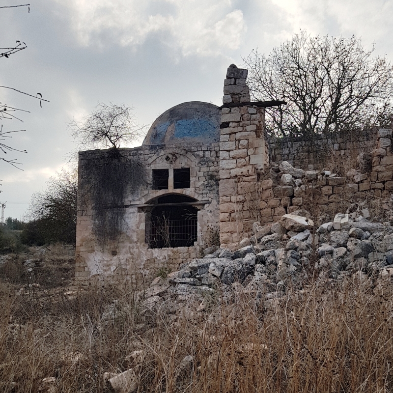
The final stretch of our hike took us to the tomb of Nebi Yusha (Prophet Joshua). It is situated across the road from the fortress, but hidden by trees, and accessible only by foot. The shrine and the surrounding ruins are a protected site. They are the remains of a small Shi’a Muslim village that was abandoned and destroyed during Israel’s War of Independence.
It was only mid-afternoon as we left the shrine. Yet the light was growing dim, and the air was chilly. We ascended to the Agamon Hahula lookout point just across the road from Moshav Ramot Naftali.
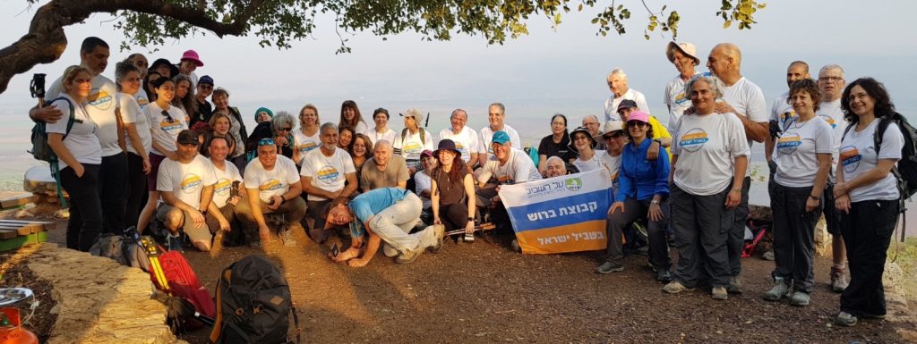
At our final stop, Avi summed up the day’s hike, and gave an award to the winner of the day’s quiz. And, of course, we posed for the requisite group photo.
The complete set of my photos, in a Flickr album: Israel Trail Hike 2021-11-25
Related blog posts:
Segment 2 – Geological Park in Kiryat Shemona to Metzudat Yesha (2009)
Segment 3 – Yesha Fortress to Nahal Dishon (Alma Bridge) (2010)