Netanya to Gaash on the Israel Trail – July 3, 2009 *
We are still in a learning mode. Many of our hiking group members are orienteers and skilled at making “route choices” while on an orienteering race course. But the Israel Trail is another challenge. The concept here requires knowing where to look for trail markers (even, and especially, on city streets), keeping them in sight, and following them! I’m sure our Trail skills will improve the more we hike.
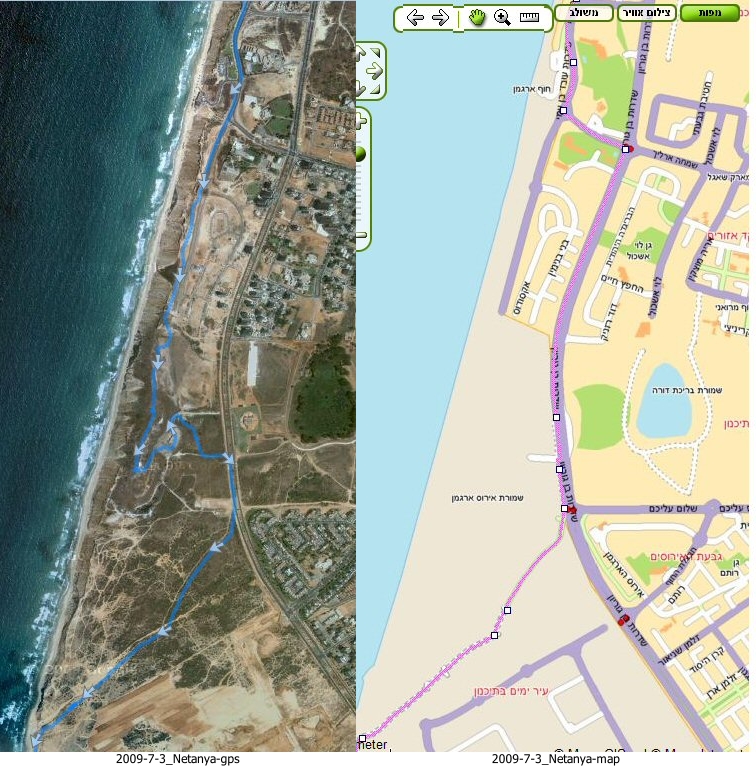
On our last hike we had two instances of deviating from the trail. The images below show where we actually hiked in those two spots, as compared to where we should have hiked according to the Israel Trail markers.
In Netanya we were simply careless about following the markers. When we didn’t see the markers, we assumed they’d been removed or obstructed due to construction of the new streets and promenade on the south side of Netanya. In fact, we should have turned left at a particular intersection, and walked along a main boulevard until we reached the entrance to the Poleg Nature Reserve.
It is interesting to note that the old garbage dump in which we found ourselves is marked on the map as the Dark Purple Iris [Hebrew: irus ha’argaman, Latin: Iris Atropurpurea] Nature Reserve. Indeed, we would have seen these flowers had we hiked here in February or March.
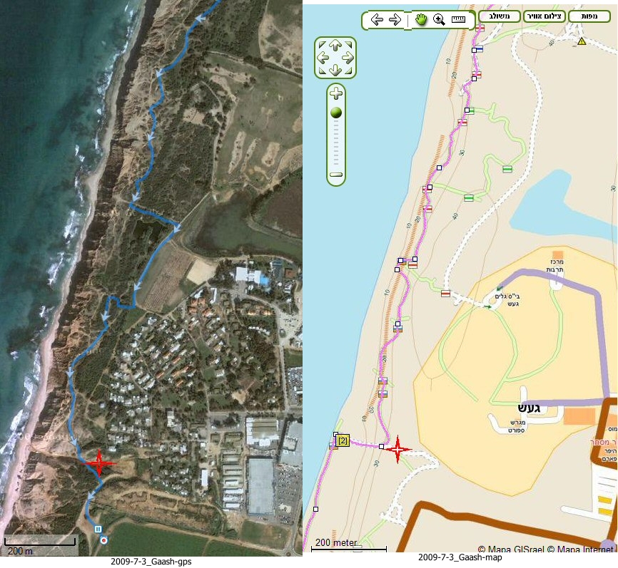
Near Gaash, at the end of the trail, we actually strayed off-course very little, and actually would have remained on-course had we not been pulled to the left (east) by one of hikers who had rushed forward ahead of us. It had already grown dark and we did not want our group to split up. Fortunately, Yuval’s great sense of direction, even in the dark, got us back on track and back to our cars most efficiently.
The red star in the second set of pictures marks the point where we exited the Israel Trail and will commence our next hike.