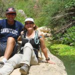
My husband Yuval and I have been riding MTBO events together for the past two years. While Yuval is a good rider, I am very much an amateur. Often we ride the course with a couple friends (who may or may not have a map). I wear a Garmin Forerunner 305 and keep a log of my sporting activities. So I know our route choices on last month’s Kivrot Hamaccabim short course (defined as 15 km) totaled just under 14 km with a climb of 240 meter, and took us just over 2 hourse to complete. In comparison, at the Eshtaol event this past Friday our route choices for the short course (defined as 10 km) totalled nearly 18 km with a climb of 420 meter. We finished in just over 3 hours.
When we rolled into the finish at nearly 7 p.m., Noam, the event organizer and course planner, was taking down the streamers, and was surprised to hear that we had done “only” 17.9 kilometers, as most riders had logged at least 20 kilometers. We have learned it is easier (and faster) for us to push our bikes up a short, steep hill rather than attempt (and likely fail) to ride a longer but more gradual climb, and that was the strategy we’d used on this course.
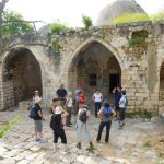
Back to the beginning. Yuval and I had planned to arrive at 14:30 and start early. But we were delayed and arrived about 15:20. We, too, got caught in the traffic jam at the start waiting for more maps to appear. Eventually we were given a Medium course map with some of the lines and controls crossed out; I put that map into my holder. Yuval went back to our car and retrieved a pen and the MTBO WOC 2009 Open course map that I’d grabbed as we were leaving the house. We copied the course from my map onto that map, and put it in Yuval’s holder. We then punched our electronic timers and took off about 15:45. Scanned map below is the one I used.
To control 1 (39). Easy route choice. Yuval turned left (almost a hairpin turn) into olive grove. I thought he was turning too early, protested (not strongly enough), told him where I (correctly) thought we were, but wasn’t vindicated until other riders confirmed our location. (split: 13 minutes)

To control 2 (34). Riding easy until the climb became too difficult for me. I think I pushed my bike about 500 meters to the top. It was very hot still and my heart rate was soaring. We decided to approach the control from the north, on a flatter trail. (split: 27 minutes)
To control 3 (37). Just after leaving the control, upon reaching the trail to the west, we found our clubmate Shmulik, who’d had an accident and was waiting for his wife and father-in-law, Micha Netzer to reach him in their jeep. He’d already gotten help from bikers, but his rescuers were having trouble locating him. We let him use our cell phone and waited while he called again. After leaving Shmulik, on our way to control 3 we received a call from Micha, still needing directions to Shmulik. After some futile discussion, Yuval realized that Micha was holding a foot-O map which did not extend as far as control 34.
Once we reached the olive groves, Yuval turned right onto the first trail. I could not understand why but followed him in. I continued south and reached the second trail while Yuval circled around on the north side of the grove. Having lost sight of Yuval, I had to use my cell phone to call and convince Yuval he was looking in the wrong place. When he finally rejoined me and examined our maps, he realized that he had been searching for the printed control 37 from the MTBO WOC event (see 37 framed in blue), and not the control 37 that he had penned in at the start. (split: 25 minutes)

To control 4 (28). We chose a route that seems to be as direct and as level as possible. We were by now very tired, and very tempted to ride on the highway. We stayed on the trail more for the sake of safety than sportsmanship. Extremely tired, I had to walk my bike up almost every hill, even the small ones. Although Yuval has better cycling power, he too, got off and pushed his bike a lot. At one point, I just had to stop and take a few-minutes rest. Eventually we reached the control. By now the sun was setting, the air was much cooler, and we felt we could finish the course. (split: 54 minutes)
 To control 5 (40). We were about to descend on the first descent into Messilat Zion, but were afraid we would hit barriers that would prevent us from getting into the village, so we took the route closer to the highway. We turned left too soon, had to climb over a huge dirt pile (meant to keep us out, of course). Realizing our mistake and location, we continued north and tried to find a shortcut through the forest to reach control 40. But a garbage dump, thickets and piles of dirt blocked everything, and we had to ride around. (split: 45 minutes)

To control 6 (41). My favorite leg! An easy ascent to get past the open area just north of the control, a short walk/push of the bike to the trail junction. From that point until control 41, it was downhill all the way. No traffic. No event center. No other riders in sight! (split 12 minutes)
To control 7 (100). Finish. (split 5 minutes)