Segments 28 – 29 – Kibbutz Dvir to Pureh Nature Reserve *
This post is dedicated to my mother Bernice Meyer Saltzman, of blessed memory, who would have celebrated her 81st birthday on March 6th, the day of this hike.
If it had been a week earlier, we would have been slopping around, cold and wet, in mud and rain (and our scheduled hike was indeed postponed). If it had been a week later, we would have been hiking in heat, and the wildflowers would be wilting. But on this first weekend in March, the forces of nature were with us, and our hike on the Israel National Trail in the northern Negev was picture perfect.
We broke an unwritten (and non-enforced) rule: we hiked this segment from south to north. This was a decision I made to avoid long round-abouts with our cars at the start and finish. No one voiced an objection or complaint. The route was just as enjoyable in either direction. There were no particular ascents or descents that we avoided as the route was essentially flat.
Our day began with an 8 a.m. meeting at the Pureh Nature Reserve turn-off on Route 40. We regrouped into 3 cars and drove to Kibbutz Dvir. The kibbutz is surrounded by a security fence, and the guard on duty was kind enough to let us drive in and park our cars just inside the entrance. Since leaving a car unattended all day in the Negev is risky, this was a good thing.
From the kibbutz’s front gate, we had to hike about a kilometer to reach the trail.

The weather was perfectly comfortable for a day out on the trail.

The wildflowers were glorious. For most of the day the trail followed Nahal Shikma (on the left in the photo below).

Since the hike was not going to be particularly long or strenuous, Yuval and I had planned a short detour to a cave marked on the map. With both Yuval and his brother Ron checking their maps, we turned off the trail, and headed up a hill covered with a mixture of wheat and wildflowers, toward a pair of power line poles. I reached the top of the hill ahead of the others, and signalled for everyone to follow me, even though I saw no sign of a cave. The vista was magnificent (though spoiled by the power lines) — the hills appeared to be covered in snow.

Yuval wandered in the wildflowers, stubbornly looking for the cave, which has been either mismarked on the maps, or simply covered when the land was cultivated.

Returning to the trail, we crossed Nahal Shikma. It was amazing to see pools of water in the stream bed. While some spots were still wet and muddy, it was not too difficult to find dry patches to step across.

We walked along a field of peas. Reminded me of my dad’s vegetable patch back in Connecticut (not in size, of course, but the taste and smell was the same).

Time for a break. For most of today’s segment of the trail, trees grow along the banks of Nahal Shikma. It was not hard to find a soft, shady, pastoral spot to stop and rest. Avner pulled out his harmonica, and serenaded us. (People weren’t in much of a singing mood this morning.)

Tel Milha loomed in the distance. It’s not really that high, but relative to the rolling hills of the northern Negev, it’s a prominent feature.

The trail offers the option of circumventing the tel or climbing it. We opted to go up.
Up on Tel Milah, Avner looks back to see where we’ve been. Yuval looks forward to see where we’re heading.

I pose in front of the vista (north is behind me). The descent is very steep. For lack of jeeps or other 4X4 vehicles, we tested our own physical ability to get down the tel.

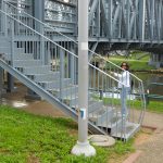
When we reached the railroad bridge (directly behind me in the photo above), we spotted a trail blaze on a tree pointing left (west). Our maps indicated that the trail heads north at this point. Apparently the the trail used to cross under the railroad and highway at this point, but now it continues north on the east side of the railroad tracks. We ended up crossing under the railroad bridge, but not the highway, and following a trail between the two. (See map at the end of this post).

It was an excellent decision. It wasn’t strictly the Israel National Trail, but I think we were close enough.

We walked through a lush meadow, not too close to the train tracks, and not too close to Highway 40.

Thanks to my MAPA website subscription, my Garmin Forerunner (GPS) and a software program called QuickRoute, you can see where we actually hiked.

Click to view the complete set of photos.
Please share your comments. In Hebrew or English.