Segment 19 – Tel Afek to Tel Aviv, along the Yarkon River *
September 25, 2010. Officially it’s now autumn. Our clocks have already been switched to winter (standard) time. But judging from the extreme and unbearable heat, it is still summer. That made it tough to be on the Israel Trail during the week of Succot, but we were eager to get back into the hiking mode.
To begin our hiking season I selected a easy segment close to home, along the Yarkon river. I gave Yuval the choice of direction. He prefered to end the hike in Ramat Hahayal where ice-cream and frozen yoghurt shops would await us. Our group comprised just 10 hikers, mostly core members and a couple guests, after several last-minute cancellations.
We began our hike just outside the Tel Afek National Park, at the Rosh HaAyin train station, shortly before 8 a.m. The sky was overcast and the air was still pleasant. Our first few kilometers sped by quickly. The trail soon brought us to the Yarkon sources. The water in this segment of the river is clear, pure and rich in vegetation and fish. At the spot where I’m standing in this photo, it is safe to swim.

Since Avner and Saraleh had hiked the Yarkon segment of the National Trail several time in the past, they suggested an alternative route around the Mekorot Hayarkon (“Yarkon Sources”) National Park. We took their advice and intentionally deviated from the trail, circumventing the park on the north-east side, rather than going along the south-west side and the Baptist Village. It was certainly lush and lovely.

One of the things I love about my hiking buddies is their knack for grazing. Here’s Saraleh enjoying a fresh fig.

And Yuval picking wild blackberries from a high branch.

Despite all its turning and winding, this segment of the Israel Trail runs alongside Highway 5 and major power lines. While we did have occasional encounters with the concrete and cable jungle, for most of the hike we felt as if we were in the wilderness.

Varda taking a moment to enjoy the flowers.

One of several water crossings.

Yuval about to enter a hidden pathway.

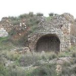
We stopped for our mid-morning snack and rest in the beautiful eucalyptus grove surrounding the Abu Rabah mill (under restoration). Just as we began munching our sandwiches, a few raindrops raised our hopes of a short shower to cool us off. No such luck.

Interesting trail blazes indicating a U-turn.

Another fun water-crossing. Avner, Ruthy and I took our shoes off and waded through barefoot. The water was warm, but my feet felt so much better (for a short time, anyway) after I put my shoes back on.

Ruthy treats some through-hikers to slices of a melon she had gleaned from a field alongside the trail. We always enjoy meeting backpackers on the trail, and today was no exception. I was especially thankful for the 5 extra minutes of rest I got while chatting with these kids.

David helps resolve our water shortage (near the end of the hike) with a few grapefruits from an orchard alongside the trail.

At this point the Yarkon is highly polluted. Beautiful only to look at.

The high-rise office towers of Atidim business park signal the end of today’s hike. Eager to finish, we shortcutted our way through the orchards, and avoided the last few twists and turns along the riverbank (blue track in map at bottom).

Zvi Gilat’s Israel Trail guidebook (3rd edition, 2005), erroneously states 18 kilometers as the length of Segment 19 (from Tel Aviv port to Tel Afek). Last winter we hiked from the Tel Aviv port to Ramat Hahayal, about one-third of the segment. That day my GPS recorded a track of about 8 kilometers, so I assumed today’s hike would be about 14-16 km. I had a lot of apologizing to do — my GPS recorded almost 21 km. We were on the trail for nearly 6 hours. And it was oppressively hot by the time we finished. Far beyond what I had anticipated. But cold Cokes and frozen yoghurts at the end of the day revived us.
The red track on the map below shows what we actually hiked, including our eastern bypass of the park. The purple track is the Israel Trail.

(Subsequently, I checked the MAPA online version of Gilat’s guidebook and found it gives a more accurate distance of 23 kilometers for Segment 19. My GPS always registers a longer distance than the “official” distances, but I don’t know why it was so significantly greater on this hike. Perhaps it’s due to all those twists and turns.)
I definitely want to revisit this section of the trail on my mountain bike. Will have to get the timing right — to avoid summer heat and winter mud.
See the complete set of today’s photos (Flickr).
Click on the SLIDESHOW button for quick and easy viewing of the set.
Please use the Comment box on my blog to share your feedback with me and the other hikers and readers. Hebrew or English is welcome!
Thanks, great story and great photos!
please check out my blog on my INT experience as well:
http://shvilist.com/Israel_national_trail
cheers!